Ghost Lake
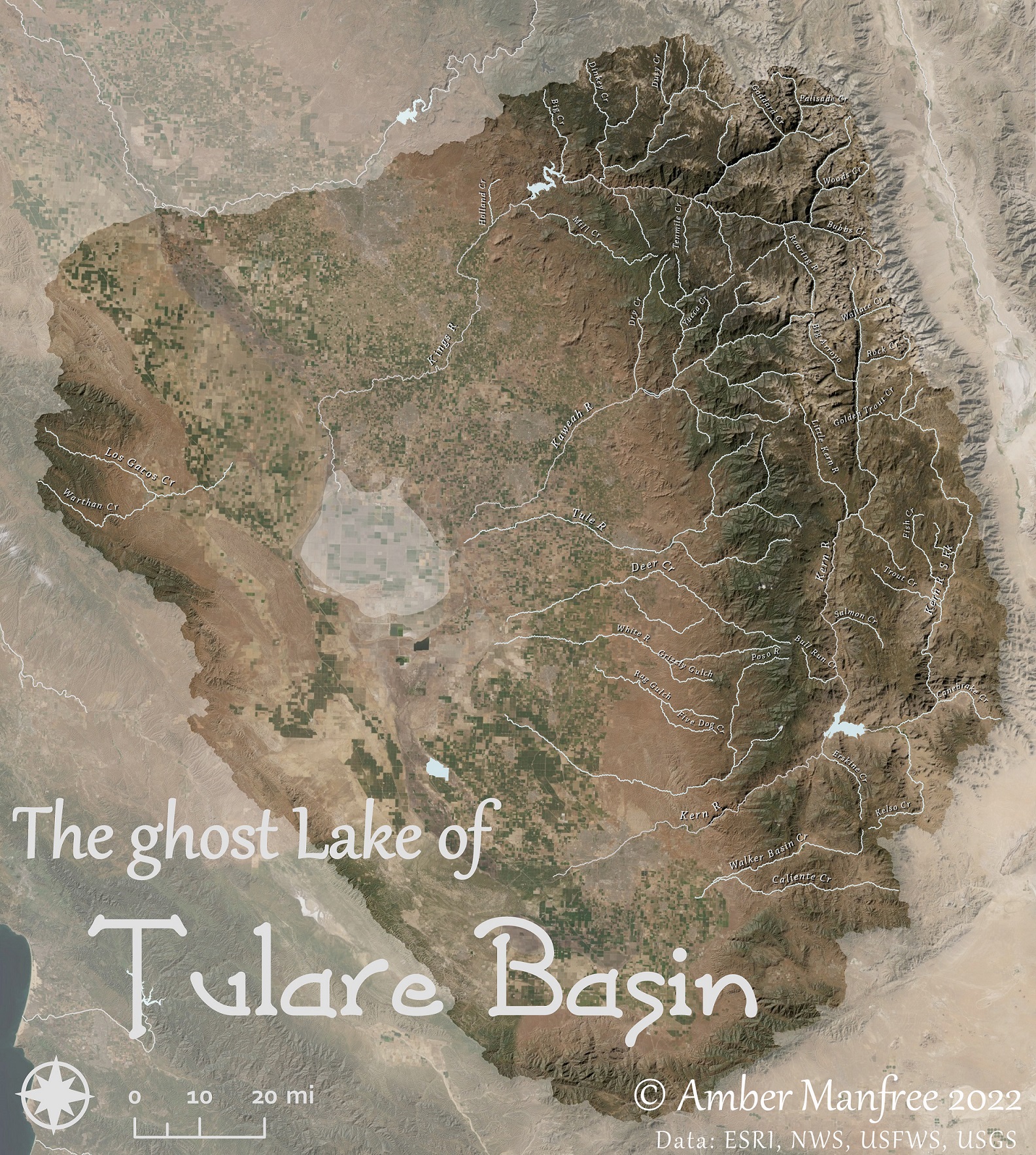
Water diversions and dropping groundwater levels have made the “largest lake in the west” a dry basin filled with farms and solar fields. Rivers disappearing into the ground point to the lost Tulare Lake.
Lahontan Redside
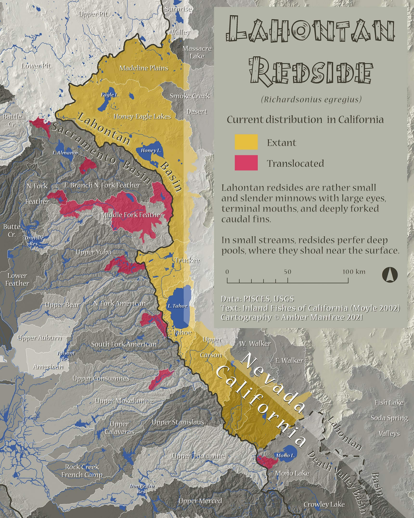
Lahontan Redside distribution in California includes now-dry Lake Lahontan watershed, and areas where they have been translocated by canals and bait buckets.
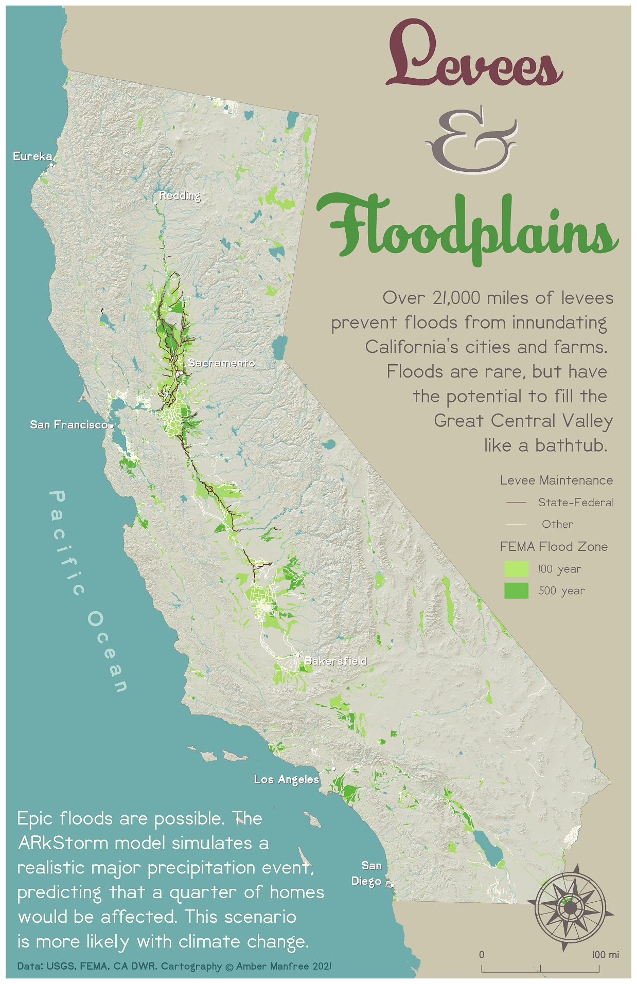
California Levees and Floodplains
Levees separate rivers and floodplains – but for how long? California’s boom-and-bust precipitation cycles keep us guessing.
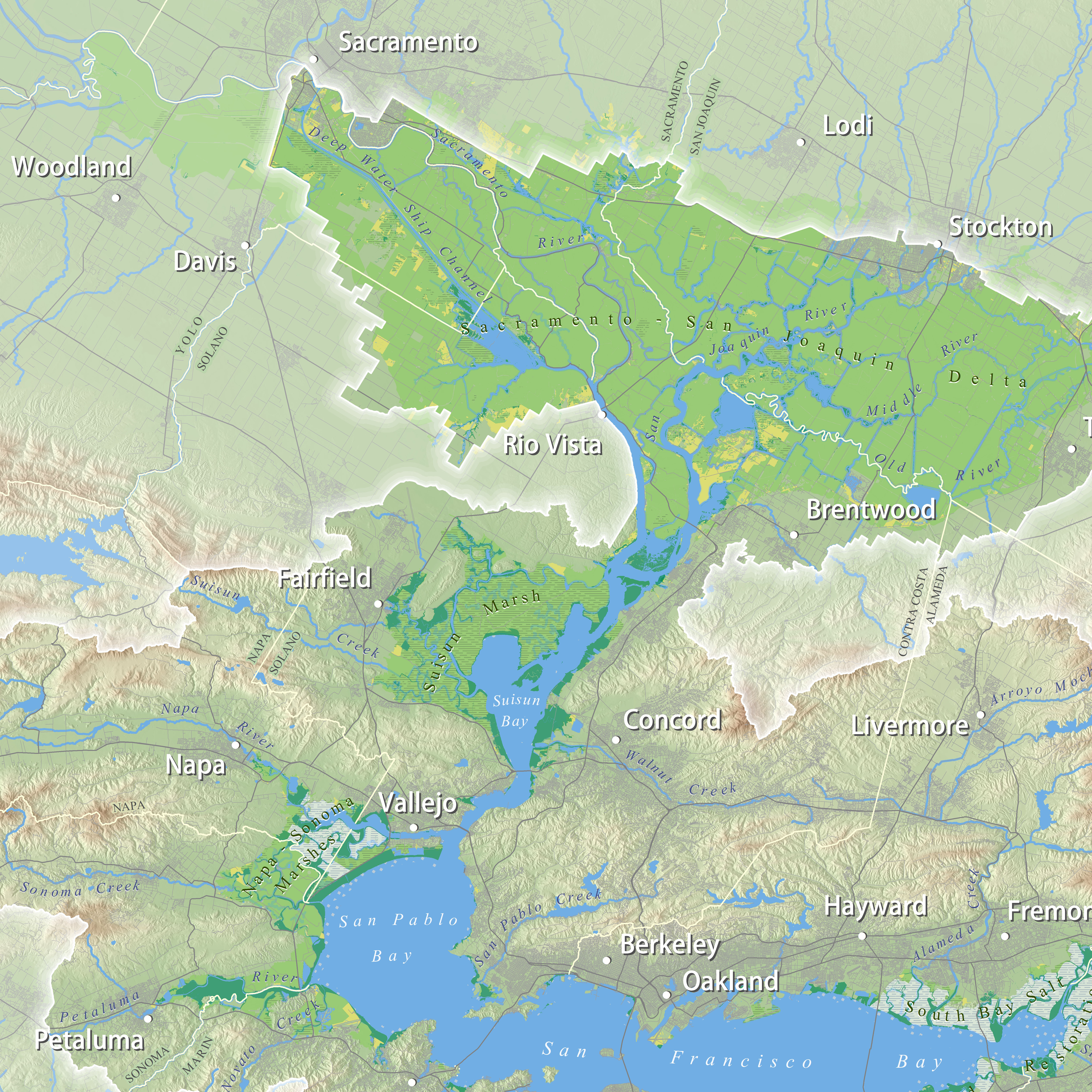
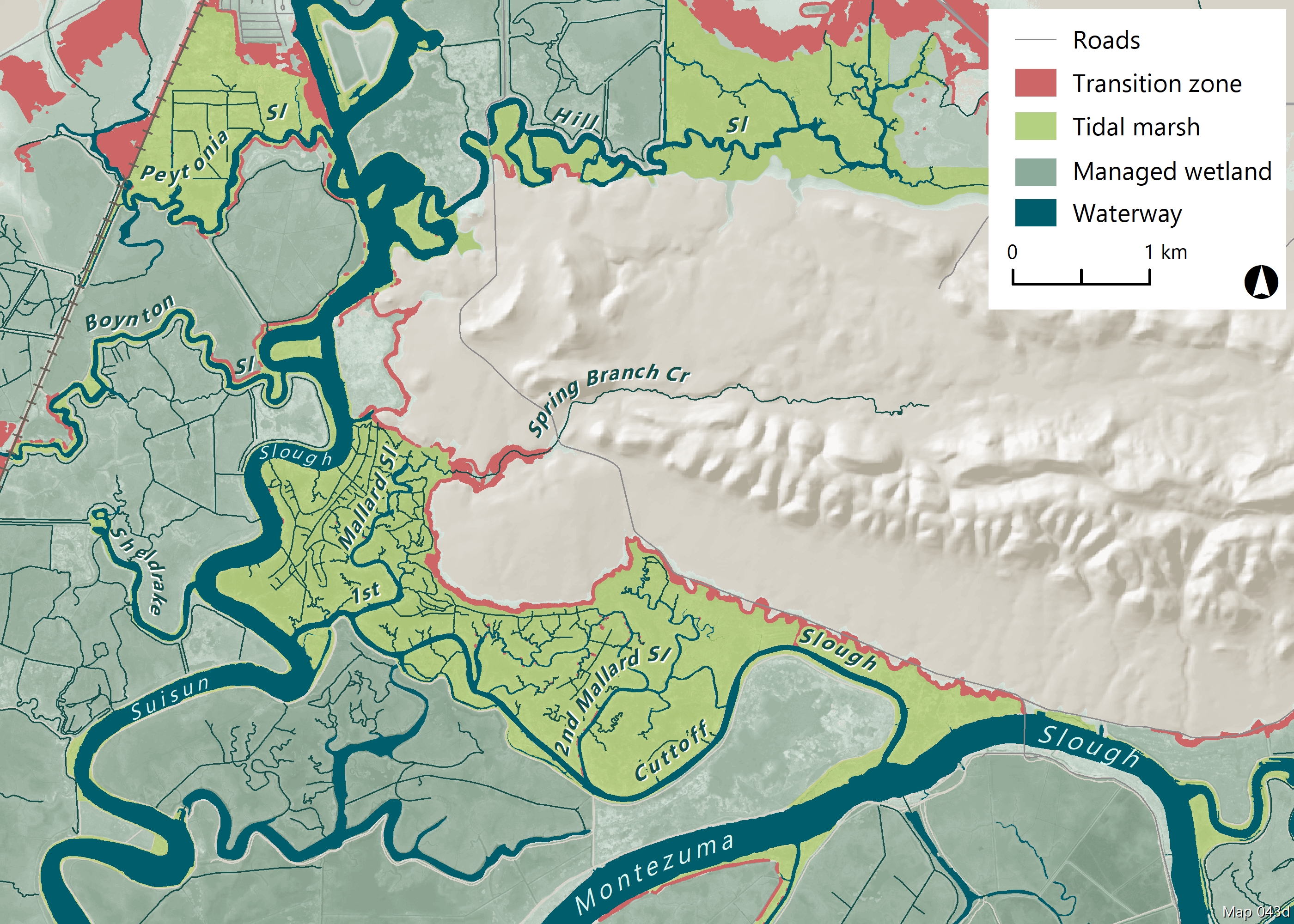
2015 State of the Estuary Report
Map program for the 2015 State of the Estuary Report by San Francisco Estuary Partnership. Copyright SFEP 2015.
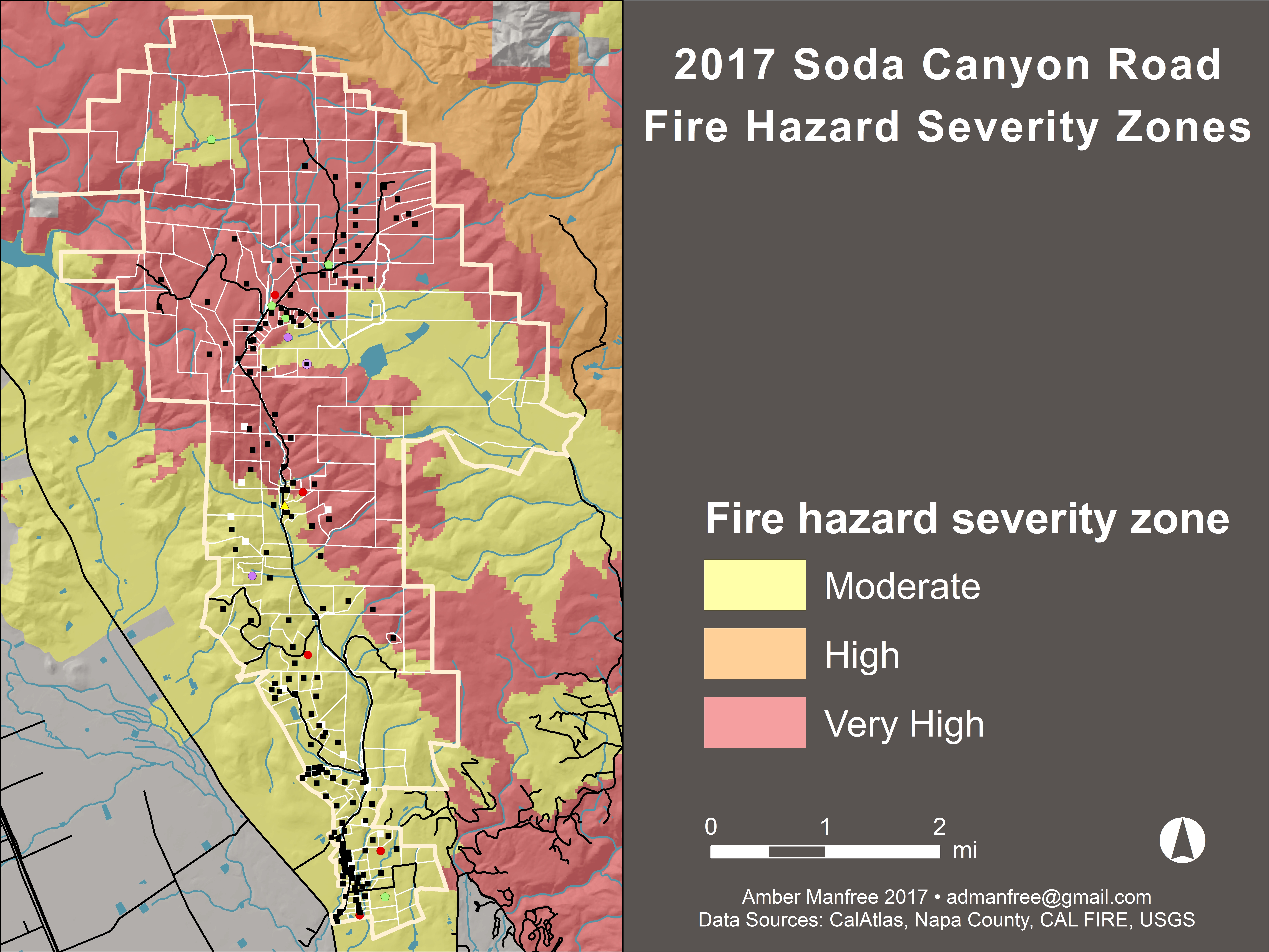
Fire Severity Zones and Road Service Area
CAL FIRE fire severity zones within the service area of Soda Canyon Road in Napa, California. Designed to accompany a presentation about fire risk.
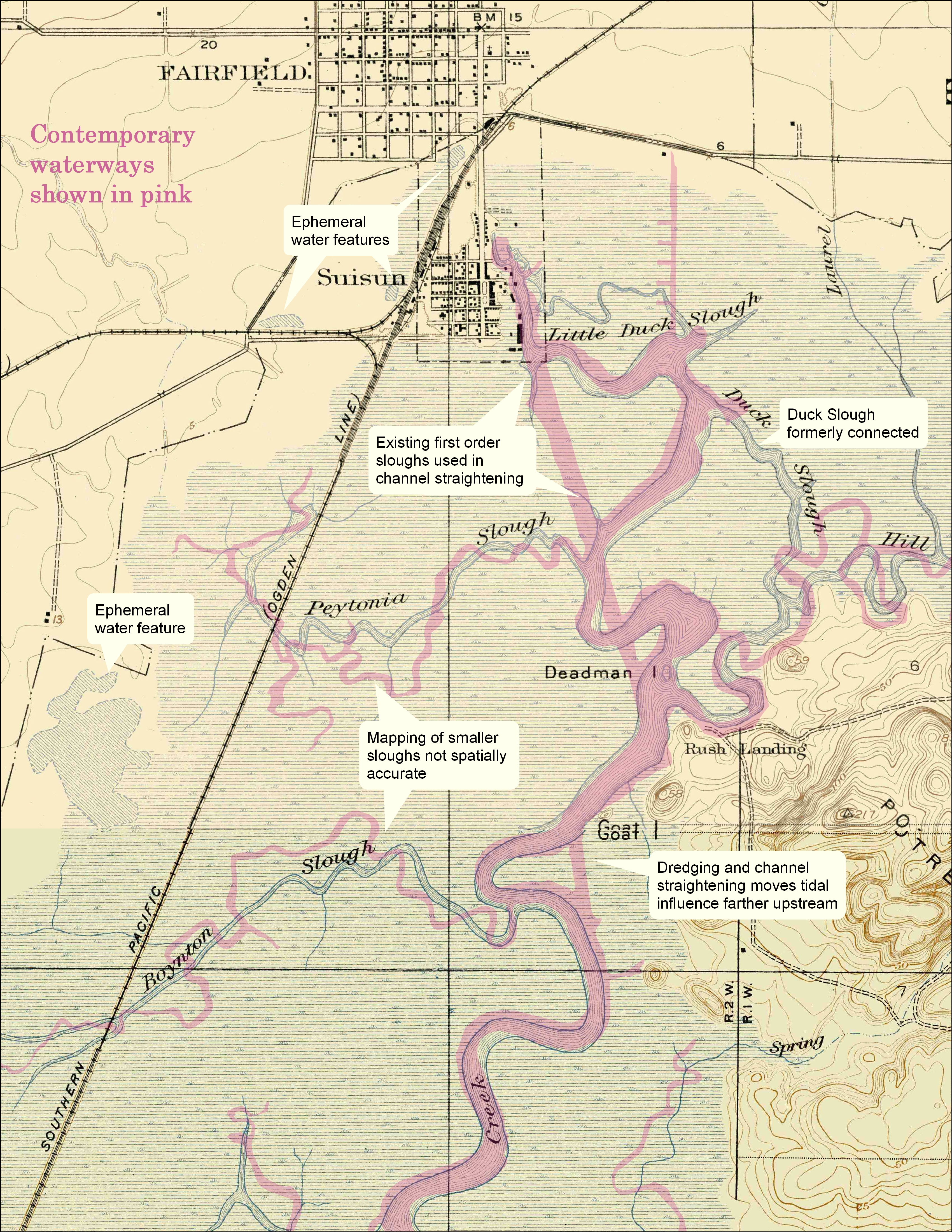
Suisun Habitat Metrics
Map series accompanying dissertation and related presentations and journal articles.
